Learn · Rocks · 9 minute read
Reading the rocks
Every layer is a page, and some pages are missing. How a doctor, a farmer and a canal surveyor learned to read them.
Every rock is a record of where it was made. A grey slab of slate was once mud on a sea floor. A lump of granite was once molten, deep under a mountain range. Geologists read rocks the way you might read old letters: what they are made of, what is inside them, and what order they come in.
Three families
Igneous rocks cool from molten rock. If magma cools slowly underground, its crystals have time to grow large, as in granite. If lava cools quickly at the surface, the crystals stay tiny, as in basalt.
Sedimentary rocks are made of bits of older rock, shells or plants, laid down in layers by water, wind or ice and then pressed and cemented together. Sandstone, mudstone, limestone and chalk are all sedimentary. Almost every fossil is found in them.
Metamorphic rocks were once something else, then were changed, without melting, by heat and pressure deep in the crust. Mudstone becomes slate. Limestone becomes marble. Granite can become gneiss, the banded rock of the oldest parts of the continents.
Oldest at the bottom
In 1669 the Danish scientist Nicolas Steno set down a rule that sounds obvious once you hear it. Layers of sediment settle one on top of another, so in a pile that has not been disturbed, the lowest layer is the oldest and the top one is the youngest. He also saw that layers are laid down flat. So if you find them tilted or folded, something moved them afterwards.
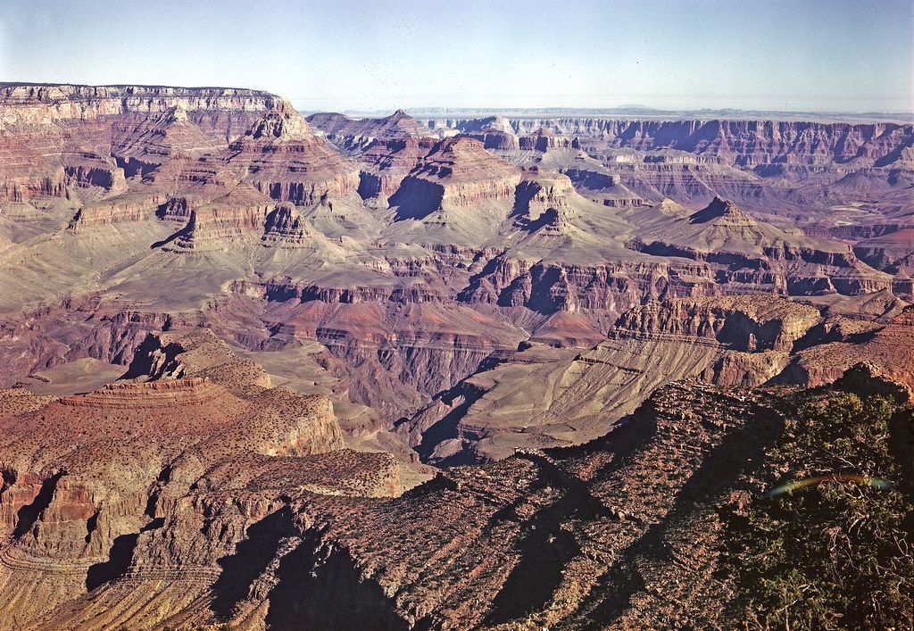
The walls of the Grand Canyon in Arizona are the textbook example. The rocks at the bottom of the inner gorge are about 1.8 billion years old. The rock at the rim, the Kaibab Formation, is about 270 million years old. The river that cut through them all has been at it for only about 5 to 6 million years.
The gap in the cliff
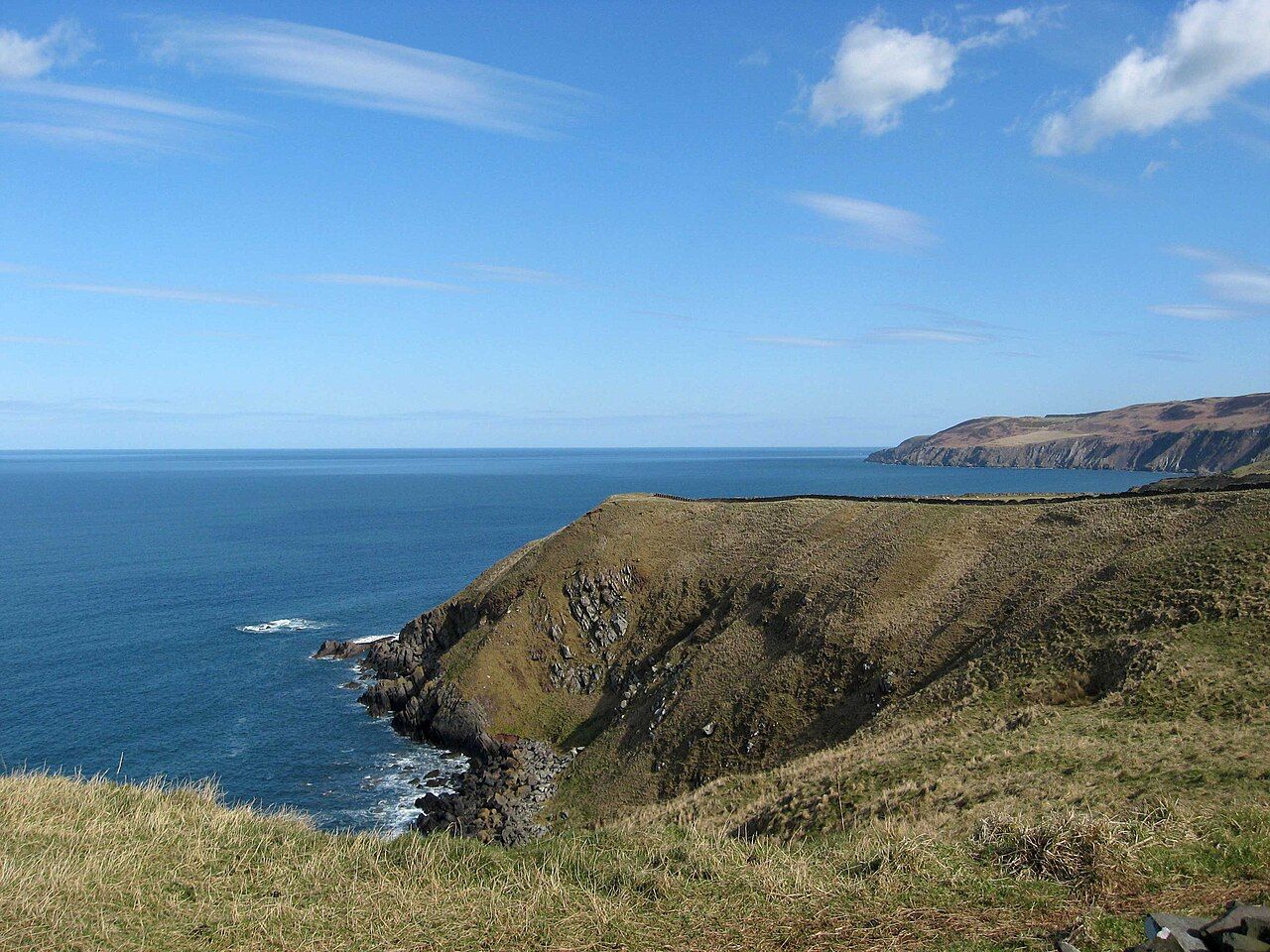
In 1788, the Edinburgh doctor and farmer James Hutton went by boat along the Berwickshire coast with two friends, the mathematician John Playfair and the geologist Sir James Hall. At Siccar Point they found what Hutton had been looking for.
At the bottom of the cliff, grey layers of hard sandstone called greywacke stand almost upright. They were laid down flat, as mud and sand on the floor of a deep ocean, about 435 million years ago. Then they were squeezed and turned on end as the continents either side of that ocean collided. Then they were worn flat. Only after all that were the red sandstone layers above them laid down, in the late Devonian, as rivers spread sand across a desert.
Each of those steps is slow, and the gap they fill is tens of millions of years. It is most often given as about 65 million. For Hutton it was proof that the Earth was immensely old, made by the same slow processes we can see working today. Playfair wrote later that "the mind seemed to grow giddy by looking so far into the abyss of time."
The map that changed the world
William Smith was a surveyor from a humble Oxfordshire family, born in 1769. In the 1790s he worked for the Somersetshire Coal Company, digging out the routes for canals and looking down into coal pits. He noticed two things. The layers of rock always came in the same order. And each layer held its own set of fossils, so that you could tell two similar-looking limestones apart by what was in them.
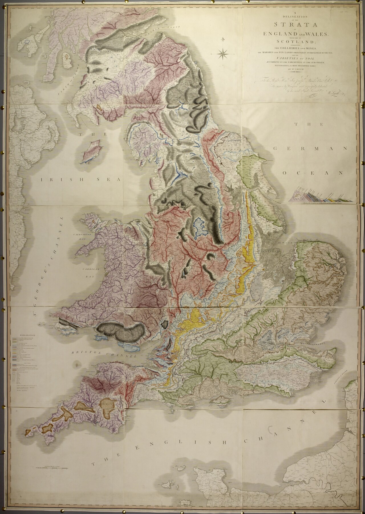
That meant you could match a layer in one place with the same layer many miles away, even when the layers in between were missing. Smith spent years walking and riding across the country doing exactly that. In 1815 he published the result: A Delineation of the Strata of England and Wales with part of Scotland, the first geological map of a whole country. Each copy was coloured by hand, with the colours chosen to look like the rocks themselves.
Smith was not invited to join the new Geological Society of London, most likely because he was not thought to be of the right class. In 1819 he spent 11 weeks in a debtors' prison. Recognition came late: in 1831 the same society gave him its first Wollaston Medal, and he is now called the father of English geology. His map is the ancestor of every geological map made since, including the ones the British Geological Survey still uses to find water, stone and safe ground to build on.