Learn · Climate · 8 minute read
Ice ages
Wobbles in our orbit set the beat. When the ice came, Britain vanished under it and the sea fell 134 metres.
An ice age, to a geologist, is any time when there are permanent ice sheets on the land. By that measure we are in one now, because Greenland and Antarctica are covered in ice kilometres thick. This one began about 2.58 million years ago, at the start of the Quaternary period.
Within it, the climate swings. In the cold spells, called glacials, ice sheets spread across North America and northern Europe. In the warm spells, called interglacials, they shrink back. We are living in an interglacial now. It began 11,700 years ago, and it is the stretch of time called the Holocene.
The rhythm in the sky
The Earth's path around the Sun is not fixed. Three slow wobbles change how much sunlight reaches each part of the planet in each season. The shape of the orbit stretches and relaxes over about 100,000 years. The tilt of the Earth's axis rocks between about 22.1° and 24.5° over about 41,000 years. And the axis itself swings round like a spinning top, which shifts the seasons along the orbit over about 23,000 years.
The Serbian scientist Milutin Milanković worked out how these combine. When northern summers are cool for long enough, the snow does not melt, and ice sheets can grow. Between about three million and one million years ago, ice ages came and went roughly every 41,000 years. About 800,000 years ago the beat slowed to about 100,000 years. Scientists are still debating why.
Britain under the ice
The last time the ice was at its greatest, the British and Irish ice sheet reached its biggest about 27,000 years ago. It covered most of Britain and Ireland and much of the North Sea floor, and stretched as far south as South Wales, north Norfolk and the Vale of York. The parts of it that rested on the sea bed had broken up by about 17,000 years ago.
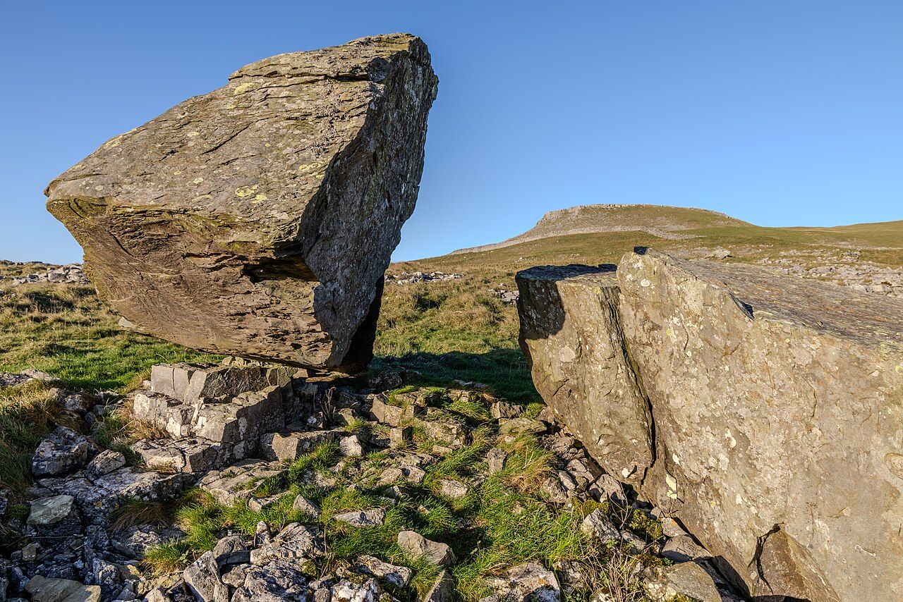
Ice sheets carry rocks with them and leave them behind when they melt. On the hillside above Austwick in the Yorkshire Dales, boulders of hard grey Silurian sandstone sit on top of much younger, pale limestone. Ice carried them there and dropped them as it melted at the end of the last glacial. Rain has since dissolved the limestone around them, so many now stand on little pedestals of the limestone they protected.
When the sea was 134 metres lower
All that ice was water taken out of the oceans. At the coldest point, between about 29,000 and 21,000 years ago, the sea was about 134 metres lower than it is today. Then the ice melted and the sea came back. Between about 16,500 and 8,200 years ago it rose by an average of 12 metres every thousand years. Between 14,500 and 14,000 years ago, it rose at 4 centimetres a year or more: about a metre every 25 years.
The rising sea drowned a whole country. Where the southern North Sea is now, there was once a low, green land of rivers, marshes and hills that joined Britain to the rest of Europe. It is called Doggerland, after the Dogger Bank. People lived there, hunting, fishing and gathering. As the sea rose it shrank to a chain of islands. About 8,150 years ago, an enormous underwater landslide off Norway, the Storegga slide, sent a tsunami across the North Sea. A study of sediment cores in 2020 found that it struck what was left of Doggerland, though the highest ground may have survived it. In the end the rising sea covered everything, and Britain became an island.
The story of what people did as the ice melted carries on in our sister site, Our Centuries: when farming began, and prehistoric Britain, layer by layer.